 vesseltracker.com
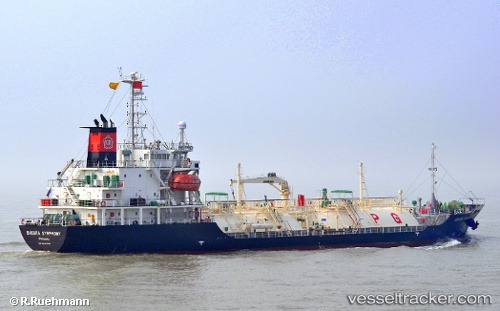
Vessel LADY THALASSA IMO: 9447378, MMSI: 352978216 LPG Tanker
UTC, 22.16947, 114.13313, course: 75, speed: 0
UTC, 22.16811, 114.13197, course: 201, speed: 5.6
2026-02-22 17:44:40 UTC, 21.96251, 114.03936, course: 214, speed: 11.1
Live AIS position:
UTC. Near WAILINGDING ISLAND),
updated 2026-02-22 17:44:40 UTC.
Find the position of the vessel LADY THALASSA on the map. The latter are known coordinates and path.
marine traffic ship tracker show on live map
The current position of vessel LADY THALASSA is 21.96251 lat / 114.03936 lng. Updated: 2026-02-22 17:44:40 UTCCurrently sailing under the flag of Panama
LADY THALASSA built in 2008 year
Deadweight:
3161 tDetails:
Last coordinates of the vessel:
UTC, 22.16948, 114.13314, course: 79, speed: 0UTC, 22.16947, 114.13313, course: 75, speed: 0
UTC, 22.16811, 114.13197, course: 201, speed: 5.6
2026-02-22 17:44:40 UTC, 21.96251, 114.03936, course: 214, speed: 11.1