 vesseltracker.com
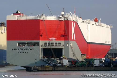
Vessel Apollon Highway IMO: 9728083, MMSI: 353013000 Vehicles Carrier
UTC, 35.46146, 139.69733, course: 60, speed: 0.1
UTC, 35.46146, 139.69739, course: 60, speed: 0
2026-03-14 18:03:54 UTC, 35.46146, 139.69740, course: 60, speed: 0
Live Vessel Apollon Highway Analytics (details, animations, etc.)
Live AIS position: UTC. Near Yokohama), updated 2026-03-14 18:03:54 UTC.Find the position of the vessel Apollon Highway on the map. The latter are known coordinates and path.
marine traffic ship tracker show on live map
The current position of vessel Apollon Highway is 35.46146 lat / 139.69740 lng. Updated: 2026-03-14 18:03:54 UTCCurrently sailing under the flag of Panama
Details:
Last coordinates of the vessel:
UTC, 35.46144, 139.69740, course: 60, speed: 0UTC, 35.46146, 139.69733, course: 60, speed: 0.1
UTC, 35.46146, 139.69739, course: 60, speed: 0
2026-03-14 18:03:54 UTC, 35.46146, 139.69740, course: 60, speed: 0