 vesseltracker.com
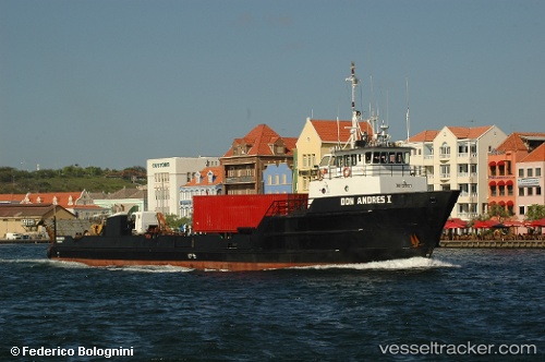
Don Andres I
Current StatusWhere is the vessel?
Don Andres I is currently in Near Zeelandia, based on AIS data received about 1h ago.
Latest AIS update:
Current position: 12.11333° N, 68.91167° W (Near Zeelandia)
Average speed (last 7 days): Loading…
Average speed (last 30 days): Loading…
Vessel profile: Don Andres I is a Deck Cargo Ship with dimensions 8m x 44m.
This page combines live AIS, route history, probable destination signals, nearby traffic, and port activity for practical vessel monitoring.
The current position of vessel Don Andres I is 12.11333 lat / -68.91167 lng. Updated: 2026-04-07 17:27:25 UTCNearest reference points:
- Near Bullenbaai
- Near Las Piedras
- 24 nm NW of Palm Beach
Details:
Live Vessel Don Andres I Analytics (details, animations, etc.)
Recent AIS points (UTC):
2026-04-07 11:39:25 UTC · 12.11333, -68.91167 · SOG 0 kn · COG -1°2026-04-07 14:03:28 UTC · 12.11333, -68.91167 · SOG 0 kn · COG -1°
2026-04-07 15:42:29 UTC · 12.11333, -68.91333 · SOG 0 kn · COG -1°
2026-04-07 17:27:25 UTC · 12.11333, -68.91167 · SOG 0 kn · COG -1°