 vesseltracker.com
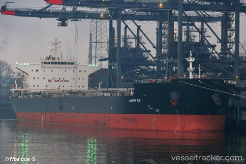
Vessel ALKYON IMO: 9511430, MMSI: 353393000 Bulk Carrier
UTC, 41.52832, 31.90595, course: 105, speed: 0
UTC, 41.52833, 31.90597, course: 105, speed: 0
2026-03-15 22:12:44 UTC, 41.52833, 31.90597, course: 105, speed: 0.1
Live Vessel ALKYON Analytics (details, animations, etc.)
Live AIS position: UTC. Near EREN), updated 2026-03-15 22:12:44 UTC.Find the position of the vessel ALKYON on the map. The latter are known coordinates and path.
marine traffic ship tracker show on live map
The current position of vessel ALKYON is 41.52833 lat / 31.90597 lng. Updated: 2026-03-15 22:12:44 UTCCurrently sailing under the flag of Panama
ALKYON built in 2011 year
Deadweight:
87450 tDetails:
Last coordinates of the vessel:
UTC, 41.52833, 31.90603, course: 105, speed: 0UTC, 41.52832, 31.90595, course: 105, speed: 0
UTC, 41.52833, 31.90597, course: 105, speed: 0
2026-03-15 22:12:44 UTC, 41.52833, 31.90597, course: 105, speed: 0.1