 vesseltracker.com
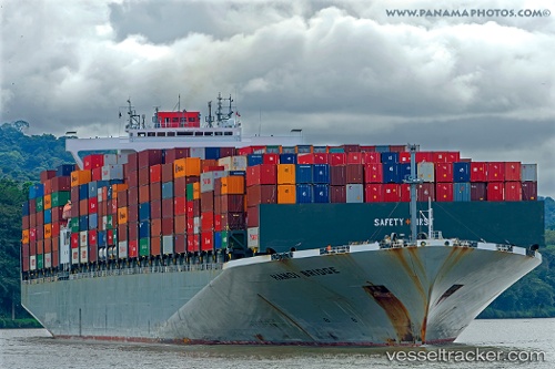
Vessel Hanoi Bridge IMO: 9588093, MMSI: 353592000 Container Ship
UTC, 50.43133, -3.36440, course: 100, speed: 8
UTC, 50.45207, -2.85937, course: 99, speed: 8.9
2026-02-04 23:58:13 UTC, 50.31770, -2.45245, course: 91, speed: 7.6
Live AIS position:
UTC. 15 nm S of Castletown),
updated 2026-02-04 23:58:13 UTC.
Find the position of the vessel Hanoi Bridge on the map. The latter are known coordinates and path.
marine traffic ship tracker show on live map
The current position of vessel Hanoi Bridge is 50.31770 lat / -2.45245 lng. Updated: 2026-02-04 23:58:13 UTCCurrently sailing under the flag of Panama
Hanoi Bridge built in 2013 year
Deadweight:
96980 tDetails:
Last coordinates of the vessel:
UTC, 50.43595, -3.43232, course: 117, speed: 0.6UTC, 50.43133, -3.36440, course: 100, speed: 8
UTC, 50.45207, -2.85937, course: 99, speed: 8.9
2026-02-04 23:58:13 UTC, 50.31770, -2.45245, course: 91, speed: 7.6