 vesseltracker.com
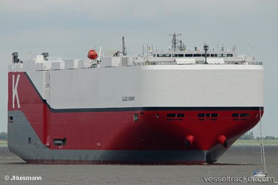
Vessel Iguazu Highway IMO: 9827243, MMSI: 353706000 Vehicles Carrier
UTC, 10.51599, 102.14176, course: 148, speed: 14.6
UTC, 10.12333, 102.38667, course: -1, speed: 14
2026-01-28 18:20:23 UTC, 9.69167, 102.58833, course: -1, speed: 14
Live AIS position:
UTC. 65 nm NW of Dai Hung (STS Load)),
updated 2026-01-28 18:20:23 UTC.
Find the position of the vessel Iguazu Highway on the map. The latter are known coordinates and path.
marine traffic ship tracker show on live map
The current position of vessel Iguazu Highway is 9.69167 lat / 102.58833 lng. Updated: 2026-01-28 18:20:23 UTCCurrently sailing under the flag of Panama
Details:
Last coordinates of the vessel:
UTC, 11.13489, 101.72373, course: 146, speed: 15.4UTC, 10.51599, 102.14176, course: 148, speed: 14.6
UTC, 10.12333, 102.38667, course: -1, speed: 14
2026-01-28 18:20:23 UTC, 9.69167, 102.58833, course: -1, speed: 14