 vesseltracker.com
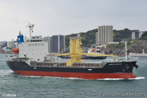
Vessel Ocean Harmony IMO: 9800752, MMSI: 353898000 General Cargo Ship
UTC, 34.49138, 129.15591, course: 199, speed: 9.9
UTC, 34.09498, 129.06589, course: 194, speed: 10.5
2026-02-22 15:49:47 UTC, 33.78298, 129.02689, course: 184, speed: 9.1
Live AIS position:
UTC. 28 nm SW of IZUHARA),
updated 2026-02-22 15:49:47 UTC.
Find the position of the vessel Ocean Harmony on the map. The latter are known coordinates and path.
marine traffic ship tracker show on live map
The current position of vessel Ocean Harmony is 33.78298 lat / 129.02689 lng. Updated: 2026-02-22 15:49:47 UTCCurrently sailing under the flag of Panama
Details:
Last coordinates of the vessel:
UTC, 34.79615, 129.14648, course: 170, speed: 9.9UTC, 34.49138, 129.15591, course: 199, speed: 9.9
UTC, 34.09498, 129.06589, course: 194, speed: 10.5
2026-02-22 15:49:47 UTC, 33.78298, 129.02689, course: 184, speed: 9.1