 vesseltracker.com
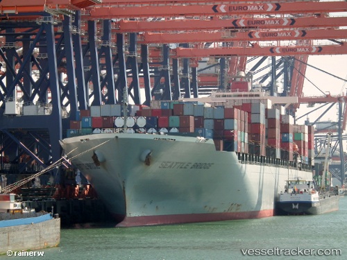
Vessel Seattle Bridge IMO: 9560352, MMSI: 353903000 Container Ship
UTC, 31.28332, 131.40834, course: 58, speed: 13.9
UTC, 31.41015, 131.64880, course: 64, speed: 15.8
2026-01-15 19:28:31 UTC, 31.55067, 131.90723, course: 68, speed: 16.2
Live AIS position:
UTC. 26 nm E of ABURATSU),
updated 2026-01-15 19:28:31 UTC.
Find the position of the vessel Seattle Bridge on the map. The latter are known coordinates and path.
marine traffic ship tracker show on live map
The current position of vessel Seattle Bridge is 31.55067 lat / 131.90723 lng. Updated: 2026-01-15 19:28:31 UTCCurrently sailing under the flag of Panama
Seattle Bridge built in 2010 year
Deadweight:
72890 tDetails:
Last coordinates of the vessel:
UTC, 31.20434, 131.25250, course: 63, speed: 13.6UTC, 31.28332, 131.40834, course: 58, speed: 13.9
UTC, 31.41015, 131.64880, course: 64, speed: 15.8
2026-01-15 19:28:31 UTC, 31.55067, 131.90723, course: 68, speed: 16.2