 vesseltracker.com
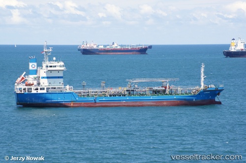
Vessel Leros IMO: 9382152, MMSI: 354089000 Oil Products Tanker
UTC, 31.44324, 32.48418, course: 291, speed: 0
UTC, 31.44325, 32.48415, course: 289, speed: 0
2026-02-01 01:39:49 UTC, 31.44439, 32.48384, course: 245, speed: 0.1
Live AIS position:
UTC. 14 nm NE of Port Said),
updated 2026-02-01 01:39:49 UTC.
Find the position of the vessel Leros on the map. The latter are known coordinates and path.
marine traffic ship tracker show on live map
The current position of vessel Leros is 31.44439 lat / 32.48384 lng. Updated: 2026-02-01 01:39:49 UTCDetails:
Last coordinates of the vessel:
UTC, 31.44301, 32.48411, course: 298, speed: 0UTC, 31.44324, 32.48418, course: 291, speed: 0
UTC, 31.44325, 32.48415, course: 289, speed: 0
2026-02-01 01:39:49 UTC, 31.44439, 32.48384, course: 245, speed: 0.1