 vesseltracker.com
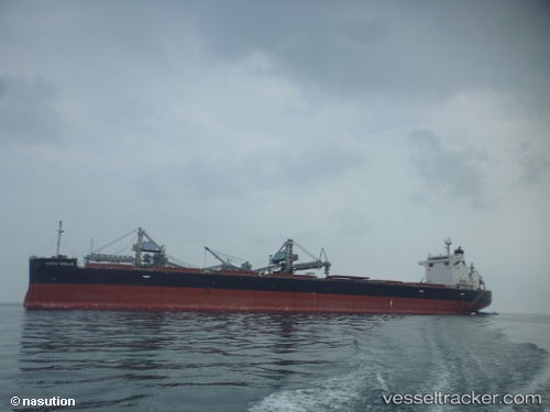
Vessel Santa Emilia IMO: 9609524, MMSI: 354227000 Bulk Carrier
UTC, 21.44947, 113.35034, course: 237, speed: 11.2
UTC, 21.21513, 112.94229, course: 240, speed: 11.5
2026-02-19 21:26:29 UTC, 21.10896, 112.76128, course: 237, speed: 11.6
Live AIS position:
UTC. 30 nm S of Shadi),
updated 2026-02-19 21:26:29 UTC.
Find the position of the vessel Santa Emilia on the map. The latter are known coordinates and path.
marine traffic ship tracker show on live map
The current position of vessel Santa Emilia is 21.10896 lat / 112.76128 lng. Updated: 2026-02-19 21:26:29 UTCDetails:
Last coordinates of the vessel:
UTC, 21.60621, 113.62124, course: 234, speed: 11.4UTC, 21.44947, 113.35034, course: 237, speed: 11.2
UTC, 21.21513, 112.94229, course: 240, speed: 11.5
2026-02-19 21:26:29 UTC, 21.10896, 112.76128, course: 237, speed: 11.6