 vesseltracker.com
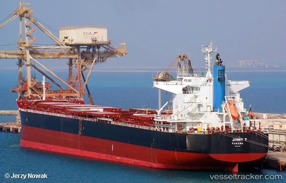
Vessel Jimmy T IMO: 9782118, MMSI: 355109000 Bulk Carrier
UTC, 8.72154, 78.36984, course: 87, speed: 11.3
UTC, 8.44853, 78.49259, course: 178, speed: 12.5
2026-02-07 13:18:46 UTC, 8.24118, 78.49242, course: 178, speed: 12.7
Live AIS position:
UTC. 33 nm SE of Tuticorin),
updated 2026-02-07 13:18:46 UTC.
Find the position of the vessel Jimmy T on the map. The latter are known coordinates and path.
marine traffic ship tracker show on live map
The current position of vessel Jimmy T is 8.24118 lat / 78.49242 lng. Updated: 2026-02-07 13:18:46 UTCDetails:
Last coordinates of the vessel:
UTC, 8.75723, 78.21022, course: 294, speed: 0UTC, 8.72154, 78.36984, course: 87, speed: 11.3
UTC, 8.44853, 78.49259, course: 178, speed: 12.5
2026-02-07 13:18:46 UTC, 8.24118, 78.49242, course: 178, speed: 12.7