 vesseltracker.com
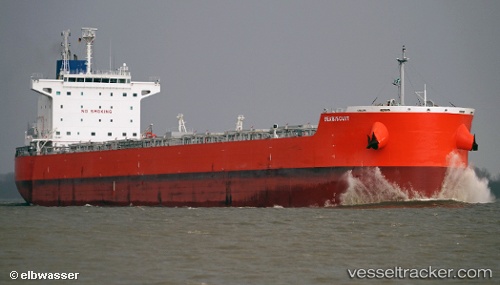
Vessel Seabiscuit IMO: 9619787, MMSI: 355140000 Bulk Carrier
UTC, 31.09584, 122.34128, course: 85, speed: 10
UTC, 31.08946, 122.67056, course: 77, speed: 12.9
2026-03-10 16:59:05 UTC, 31.09271, 123.07052, course: 80, speed: 13
Live Vessel Seabiscuit Analytics (details, animations, etc.)
Live AIS position: UTC. 29 nm NE of Lü-hua Shan), updated 2026-03-10 16:59:05 UTC.Find the position of the vessel Seabiscuit on the map. The latter are known coordinates and path.
marine traffic ship tracker show on live map
The current position of vessel Seabiscuit is 31.09271 lat / 123.07052 lng. Updated: 2026-03-10 16:59:05 UTCCurrently sailing under the flag of Panama
Details:
Last coordinates of the vessel:
UTC, 31.26146, 121.89021, course: 107, speed: 13.2UTC, 31.09584, 122.34128, course: 85, speed: 10
UTC, 31.08946, 122.67056, course: 77, speed: 12.9
2026-03-10 16:59:05 UTC, 31.09271, 123.07052, course: 80, speed: 13