 vesseltracker.com
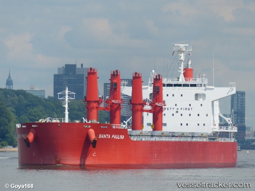
Vessel Santa Paulina IMO: 9642203, MMSI: 355142000 Bulk Carrier
UTC, 22.30215, 91.73311, course: 148, speed: 0.7
UTC, 22.30208, 91.73501, course: 161, speed: 0.1
2026-02-22 21:48:26 UTC, 22.30114, 91.73408, course: 158, speed: 0.1
Live AIS position:
UTC. Near Chittagong),
updated 2026-02-22 21:48:26 UTC.
Find the position of the vessel Santa Paulina on the map. The latter are known coordinates and path.
marine traffic ship tracker show on live map
The current position of vessel Santa Paulina is 22.30114 lat / 91.73408 lng. Updated: 2026-02-22 21:48:26 UTCDetails:
Last coordinates of the vessel:
UTC, 22.29481, 91.73562, course: 343, speed: 0UTC, 22.30215, 91.73311, course: 148, speed: 0.7
UTC, 22.30208, 91.73501, course: 161, speed: 0.1
2026-02-22 21:48:26 UTC, 22.30114, 91.73408, course: 158, speed: 0.1