 vesseltracker.com
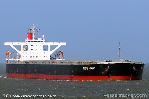
Vessel Cape Unity IMO: 9406489, MMSI: 355458000 Bulk Carrier
UTC, 37.58340, 121.38357, course: 270, speed: 0
UTC, 37.58339, 121.38355, course: 270, speed: 0
2026-02-03 12:21:11 UTC, 37.58340, 121.38357, course: 270, speed: 0
Live AIS position:
UTC. Near Yantai),
updated 2026-02-03 12:21:11 UTC.
Find the position of the vessel Cape Unity on the map. The latter are known coordinates and path.
marine traffic ship tracker show on live map
The current position of vessel Cape Unity is 37.58340 lat / 121.38357 lng. Updated: 2026-02-03 12:21:11 UTCDetails:
Last coordinates of the vessel:
UTC, 37.58342, 121.38357, course: 270, speed: 0UTC, 37.58340, 121.38357, course: 270, speed: 0
UTC, 37.58339, 121.38355, course: 270, speed: 0
2026-02-03 12:21:11 UTC, 37.58340, 121.38357, course: 270, speed: 0