 vesseltracker.com
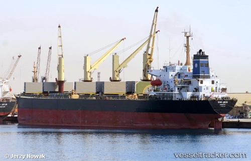
Vessel Tatiana P IMO: 9077305, MMSI: 355814000 Bulk Carrier
UTC, 10.40531, -14.82243, course: -1, speed: 0
UTC, 10.40475, -14.82185, course: 5, speed: 0
2026-02-28 23:30:18 UTC, 10.40470, -14.82163, course: 356, speed: 0.1
Live AIS position:
UTC. Near Port de Boké),
updated 2026-02-28 23:30:18 UTC.
Find the position of the vessel Tatiana P on the map. The latter are known coordinates and path.
marine traffic ship tracker show on live map
The current position of vessel Tatiana P is 10.40470 lat / -14.82163 lng. Updated: 2026-02-28 23:30:18 UTCCurrently sailing under the flag of Panama
Tatiana P built in 1995 year
Deadweight:
44809 tDetails:
Last coordinates of the vessel:
UTC, 10.41050, -14.82233, course: 169, speed: 0UTC, 10.40531, -14.82243, course: -1, speed: 0
UTC, 10.40475, -14.82185, course: 5, speed: 0
2026-02-28 23:30:18 UTC, 10.40470, -14.82163, course: 356, speed: 0.1