 vesseltracker.com
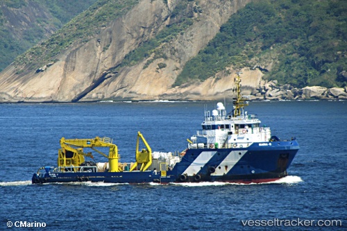
Vessel Maria g IMO: 9480875, MMSI: 355990000 Offshore Tug Supply Ship
UTC, 1.30438, 103.68295, course: 355, speed: 0
UTC, 1.30439, 103.68298, course: 354, speed: 0
2026-01-18 04:25:40 UTC, 1.30441, 103.68295, course: 353, speed: 0
Live AIS position:
UTC. Near Pioneer),
updated 2026-01-18 04:25:40 UTC.
Find the position of the vessel Maria g on the map. The latter are known coordinates and path.
marine traffic ship tracker show on live map
The current position of vessel Maria g is 1.30441 lat / 103.68295 lng. Updated: 2026-01-18 04:25:40 UTCCurrently sailing under the flag of Panama
Maria g built in 2009 year
Deadweight:
1126 tDetails:
Last coordinates of the vessel:
UTC, 1.30438, 103.68294, course: 355, speed: 0UTC, 1.30438, 103.68295, course: 355, speed: 0
UTC, 1.30439, 103.68298, course: 354, speed: 0
2026-01-18 04:25:40 UTC, 1.30441, 103.68295, course: 353, speed: 0