 vesseltracker.com
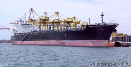
Vessel Tamiat Navigator IMO: 9422237, MMSI: 356150000 Chemical Oil Products Tanker
UTC, 52.41772, 4.74889, course: 169, speed: 0
UTC, 52.41775, 4.74888, course: 169, speed: 0
2026-01-28 07:56:35 UTC, 52.41776, 4.74884, course: 170, speed: 0
Live AIS position:
UTC. Near NAUERNA),
updated 2026-01-28 07:56:35 UTC.
Find the position of the vessel Tamiat Navigator on the map. The latter are known coordinates and path.
marine traffic ship tracker show on live map
The current position of vessel Tamiat Navigator is 52.41776 lat / 4.74884 lng. Updated: 2026-01-28 07:56:35 UTCCurrently sailing under the flag of Panama
Tamiat Navigator built in 2010 year
Deadweight:
46625 tDetails:
Last coordinates of the vessel:
UTC, 52.41771, 4.74889, course: 170, speed: 0UTC, 52.41772, 4.74889, course: 169, speed: 0
UTC, 52.41775, 4.74888, course: 169, speed: 0
2026-01-28 07:56:35 UTC, 52.41776, 4.74884, course: 170, speed: 0