 vesseltracker.com
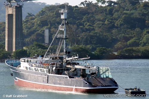
Vessel SEA TUNA I IMO: 7123473, MMSI: 356263000 Fishing Vessel
UTC, 8.92790, -79.53193, course: -1, speed: 0.1
UTC, 8.92784, -79.53214, course: -1, speed: 0.1
2026-03-02 13:26:23 UTC, 8.92784, -79.53225, course: -1, speed: 0.2
Live AIS position:
UTC. Near El Chorrillo),
updated 2026-03-02 13:26:23 UTC.
Find the position of the vessel SEA TUNA I on the map. The latter are known coordinates and path.
marine traffic ship tracker show on live map
The current position of vessel SEA TUNA I is 8.92784 lat / -79.53225 lng. Updated: 2026-03-02 13:26:23 UTCCurrently sailing under the flag of Panama
SEA TUNA I built in 1971 year
Deadweight:
0 tDetails:
Last coordinates of the vessel:
UTC, 8.92783, -79.53211, course: -1, speed: 0.1UTC, 8.92790, -79.53193, course: -1, speed: 0.1
UTC, 8.92784, -79.53214, course: -1, speed: 0.1
2026-03-02 13:26:23 UTC, 8.92784, -79.53225, course: -1, speed: 0.2