 vesseltracker.com
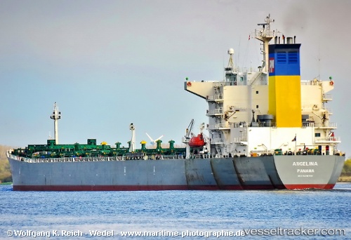
Vessel Angelina IMO: 9218791, MMSI: 356389000 Bulk Carrier
UTC, 31.10011, 32.30904, course: 7, speed: 10.4
UTC, 31.31392, 32.37077, course: 10, speed: 9.9
2026-02-02 17:54:39 UTC, 31.62333, 32.48167, course: -1, speed: 11
Live AIS position:
UTC. 23 nm N of Port Said),
updated 2026-02-02 17:54:39 UTC.
Find the position of the vessel Angelina on the map. The latter are known coordinates and path.
marine traffic ship tracker show on live map
The current position of vessel Angelina is 31.62333 lat / 32.48167 lng. Updated: 2026-02-02 17:54:39 UTCCurrently sailing under the flag of Panama
Angelina built in 2001 year
Deadweight:
74540 tDetails:
Last coordinates of the vessel:
UTC, 30.57936, 32.33237, course: 349, speed: 6.1UTC, 31.10011, 32.30904, course: 7, speed: 10.4
UTC, 31.31392, 32.37077, course: 10, speed: 9.9
2026-02-02 17:54:39 UTC, 31.62333, 32.48167, course: -1, speed: 11