 vesseltracker.com
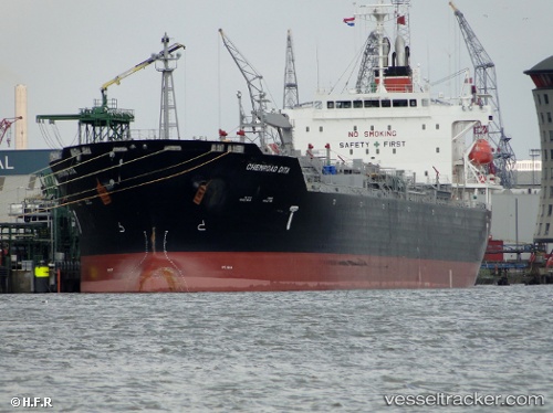
Vessel Chemroad Dita IMO: 9414242, MMSI: 356447000 Chemical Oil Products Tanker
UTC, 19.00687, -82.68581, course: 313, speed: 14.4
UTC, 19.03209, -82.71363, course: 321, speed: 14.4
2026-01-17 13:22:01 UTC, 19.34488, -83.09496, course: 311, speed: 14.2
Live AIS position:
UTC. 97 nm W of Georgetown, Grand Cayman),
updated 2026-01-17 13:22:01 UTC.
Find the position of the vessel Chemroad Dita on the map. The latter are known coordinates and path.
marine traffic ship tracker show on live map
The current position of vessel Chemroad Dita is 19.34488 lat / -83.09496 lng. Updated: 2026-01-17 13:22:01 UTCCurrently sailing under the flag of Panama
Chemroad Dita built in 2009 year
Deadweight:
33554 tDetails:
Last coordinates of the vessel:
UTC, 18.75190, -82.35423, course: 309, speed: 14.5UTC, 19.00687, -82.68581, course: 313, speed: 14.4
UTC, 19.03209, -82.71363, course: 321, speed: 14.4
2026-01-17 13:22:01 UTC, 19.34488, -83.09496, course: 311, speed: 14.2