 vesseltracker.com
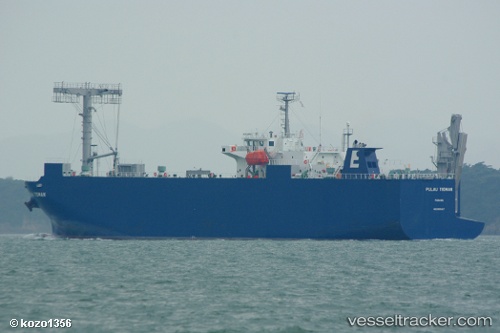
Vessel Pulau Tioman IMO: 9561617, MMSI: 356613000 Vehicles Carrier
UTC, 34.94753, 136.74416, course: 357, speed: 0.1
UTC, 34.94761, 136.74426, course: 357, speed: 0
2026-02-17 19:51:08 UTC, 34.94772, 136.74449, course: 332, speed: 0
Live AIS position:
UTC. Near Yokkaichi),
updated 2026-02-17 19:51:08 UTC.
Find the position of the vessel Pulau Tioman on the map. The latter are known coordinates and path.
marine traffic ship tracker show on live map
The current position of vessel Pulau Tioman is 34.94772 lat / 136.74449 lng. Updated: 2026-02-17 19:51:08 UTCDetails:
Last coordinates of the vessel:
UTC, 34.94752, 136.74422, course: 339, speed: 0.1UTC, 34.94753, 136.74416, course: 357, speed: 0.1
UTC, 34.94761, 136.74426, course: 357, speed: 0
2026-02-17 19:51:08 UTC, 34.94772, 136.74449, course: 332, speed: 0