 vesseltracker.com
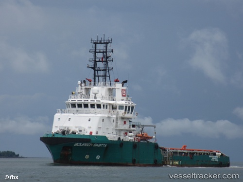
Vessel Luanda 1 IMO: 9372705, MMSI: 357029000 Offshore Tug Supply Ship
UTC, -8.74966, 13.30116, course: -1, speed: 0
UTC, -8.74974, 13.30117, course: -1, speed: 0.1
2026-01-28 07:58:45 UTC, -8.74980, 13.30119, course: -1, speed: 0
Live AIS position:
UTC. Near Luanda),
updated 2026-01-28 07:58:45 UTC.
Find the position of the vessel Luanda 1 on the map. The latter are known coordinates and path.
marine traffic ship tracker show on live map
The current position of vessel Luanda 1 is -8.74980 lat / 13.30119 lng. Updated: 2026-01-28 07:58:45 UTCCurrently sailing under the flag of Panama
Luanda 1 built in 2006 year
Deadweight:
1622 tDetails:
Last coordinates of the vessel:
UTC, -8.74966, 13.30118, course: -1, speed: 0UTC, -8.74966, 13.30116, course: -1, speed: 0
UTC, -8.74974, 13.30117, course: -1, speed: 0.1
2026-01-28 07:58:45 UTC, -8.74980, 13.30119, course: -1, speed: 0