 vesseltracker.com
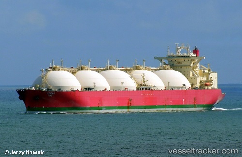
Vessel Sohar Lng IMO: 9210816, MMSI: 357186000 Lng Tanker
UTC, 13.27547, 80.34647, course: 131, speed: 0
UTC, 13.27545, 80.34650, course: 131, speed: 0
2026-01-30 12:17:50 UTC, 13.27549, 80.34649, course: 131, speed: 0
Live AIS position:
UTC. Near ENNORE),
updated 2026-01-30 12:17:50 UTC.
Find the position of the vessel Sohar Lng on the map. The latter are known coordinates and path.
marine traffic ship tracker show on live map
The current position of vessel Sohar Lng is 13.27549 lat / 80.34649 lng. Updated: 2026-01-30 12:17:50 UTCCurrently sailing under the flag of Panama
Sohar Lng built in 2001 year
Deadweight:
71997 tDetails:
Last coordinates of the vessel:
UTC, 13.27548, 80.34644, course: 131, speed: 0UTC, 13.27547, 80.34647, course: 131, speed: 0
UTC, 13.27545, 80.34650, course: 131, speed: 0
2026-01-30 12:17:50 UTC, 13.27549, 80.34649, course: 131, speed: 0