 vesseltracker.com
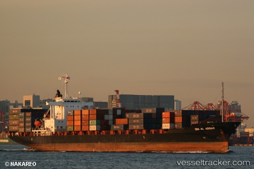
Vessel Ibn Al Abbar IMO: 9194490, MMSI: 357286000 Container Ship
UTC, 35.10357, 129.08388, course: 270, speed: 0
UTC, 35.10339, 129.08417, course: 270, speed: 0
2026-01-15 22:23:20 UTC, 35.10351, 129.08421, course: 270, speed: 0
Live AIS position:
UTC. Near Yongdang-Dong),
updated 2026-01-15 22:23:20 UTC.
Find the position of the vessel Ibn Al Abbar on the map. The latter are known coordinates and path.
marine traffic ship tracker show on live map
The current position of vessel Ibn Al Abbar is 35.10351 lat / 129.08421 lng. Updated: 2026-01-15 22:23:20 UTCDetails:
Last coordinates of the vessel:
UTC, 35.10327, 129.08405, course: 270, speed: 0UTC, 35.10357, 129.08388, course: 270, speed: 0
UTC, 35.10339, 129.08417, course: 270, speed: 0
2026-01-15 22:23:20 UTC, 35.10351, 129.08421, course: 270, speed: 0