 vesseltracker.com
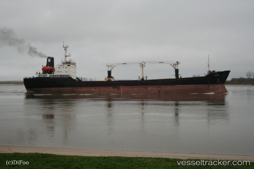
Vessel Mehmet Aga IMO: 8914312, MMSI: 357925000 General Cargo Ship
UTC, 41.37304, 19.41868, course: 207, speed: 0
UTC, 41.37302, 19.41869, course: 207, speed: 0
2026-03-15 21:21:50 UTC, 41.37301, 19.41871, course: 207, speed: 0
Live Vessel Mehmet Aga Analytics (details, animations, etc.)
Live AIS position: UTC. Near Romano Port), updated 2026-03-15 21:21:50 UTC.Find the position of the vessel Mehmet Aga on the map. The latter are known coordinates and path.
marine traffic ship tracker show on live map
The current position of vessel Mehmet Aga is 41.37301 lat / 19.41871 lng. Updated: 2026-03-15 21:21:50 UTCCurrently sailing under the flag of Panama
Mehmet Aga built in 1989 year
Deadweight:
8720 tDetails:
Last coordinates of the vessel:
UTC, 41.37302, 19.41868, course: 207, speed: 0UTC, 41.37304, 19.41868, course: 207, speed: 0
UTC, 41.37302, 19.41869, course: 207, speed: 0
2026-03-15 21:21:50 UTC, 41.37301, 19.41871, course: 207, speed: 0