 vesseltracker.com
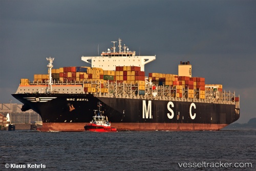
Vessel Msc Beryl IMO: 9467392, MMSI: 357926000 Container Ship
UTC, 33.65741, 124.72536, course: 281, speed: 17.9
UTC, 34.16996, 124.06444, course: 312, speed: 17.7
2026-02-23 12:05:01 UTC, 34.50232, 123.54978, course: 307, speed: 17.8
Live AIS position:
UTC. 80 nm W of Gageohyangri),
updated 2026-02-23 12:05:01 UTC.
Find the position of the vessel Msc Beryl on the map. The latter are known coordinates and path.
marine traffic ship tracker show on live map
The current position of vessel Msc Beryl is 34.50232 lat / 123.54978 lng. Updated: 2026-02-23 12:05:01 UTCCurrently sailing under the flag of Panama
Msc Beryl built in 2010 year
Deadweight:
139418 tDetails:
Last coordinates of the vessel:
UTC, 33.65741, 124.72536, course: 281, speed: 17.9UTC, 33.65741, 124.72536, course: 281, speed: 17.9
UTC, 34.16996, 124.06444, course: 312, speed: 17.7
2026-02-23 12:05:01 UTC, 34.50232, 123.54978, course: 307, speed: 17.8