 vesseltracker.com
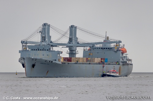
Vessel Cornhusker State IMO: 6916433, MMSI: 366574000 Crane Ship
UTC, 39.88333, -75.18333, course: -1, speed: 0
UTC, 39.88333, -75.18333, course: -1, speed: 0
2026-03-03 19:23:59 UTC, 39.88460, -75.18411, course: 174, speed: 0
Live AIS position:
UTC. Near Colwyn),
updated 2026-03-03 19:23:59 UTC.
Find the position of the vessel Cornhusker State on the map. The latter are known coordinates and path.
marine traffic ship tracker show on live map
The current position of vessel Cornhusker State is 39.88460 lat / -75.18411 lng. Updated: 2026-03-03 19:23:59 UTCDetails:
Last coordinates of the vessel:
UTC, 39.88458, -75.18414, course: 174, speed: 0UTC, 39.88333, -75.18333, course: -1, speed: 0
UTC, 39.88333, -75.18333, course: -1, speed: 0
2026-03-03 19:23:59 UTC, 39.88460, -75.18411, course: 174, speed: 0