 vesseltracker.com
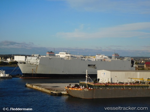
Vessel CAPE WRATH IMO: 7826166, MMSI: 366812000 Vehicles Carrier
UTC, 29.29495, -94.85713, course: -1, speed: 0
UTC, 29.29488, -94.85717, course: -1, speed: 0
2026-01-29 21:23:01 UTC, 29.29333, -94.85667, course: -1, speed: 0
Live AIS position:
UTC. Near Sheppard),
updated 2026-01-29 21:23:01 UTC.
Find the position of the vessel CAPE WRATH on the map. The latter are known coordinates and path.
marine traffic ship tracker show on live map
The current position of vessel CAPE WRATH is 29.29333 lat / -94.85667 lng. Updated: 2026-01-29 21:23:01 UTCCurrently sailing under the flag of United States of America
CAPE WRATH built in 1981 year
Deadweight:
32772 tDetails:
Last coordinates of the vessel:
UTC, 29.29333, -94.85667, course: -1, speed: 0UTC, 29.29495, -94.85713, course: -1, speed: 0
UTC, 29.29488, -94.85717, course: -1, speed: 0
2026-01-29 21:23:01 UTC, 29.29333, -94.85667, course: -1, speed: 0