 vesseltracker.com
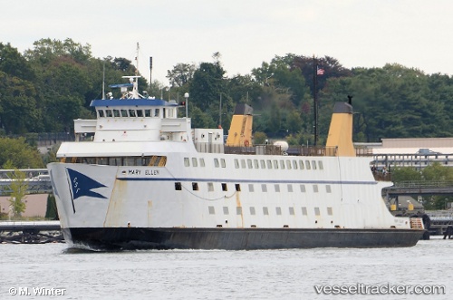
Vessel Mary Ellen IMO: 8305652, MMSI: 366898190 Passenger Ro Ro Cargo Ship
UTC, 41.15403, -72.24031, course: -1, speed: 0
UTC, 41.15403, -72.24031, course: -1, speed: 0
2026-03-01 01:07:49 UTC, 41.15403, -72.24031, course: -1, speed: 0
Live AIS position:
UTC. Near PLUM ISLAND),
updated 2026-03-01 01:07:49 UTC.
Find the position of the vessel Mary Ellen on the map. The latter are known coordinates and path.
marine traffic ship tracker show on live map
The current position of vessel Mary Ellen is 41.15403 lat / -72.24031 lng. Updated: 2026-03-01 01:07:49 UTCCurrently sailing under the flag of USA
Details:
Last coordinates of the vessel:
UTC, 41.23547, -72.17418, course: -1, speed: 14.6UTC, 41.15403, -72.24031, course: -1, speed: 0
UTC, 41.15403, -72.24031, course: -1, speed: 0
2026-03-01 01:07:49 UTC, 41.15403, -72.24031, course: -1, speed: 0