 vesseltracker.com
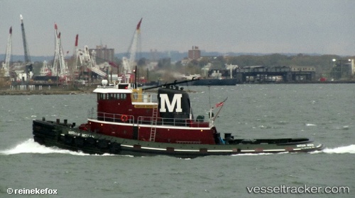
Vessel Miriam Moran IMO: 7908146, MMSI: 366939710 Tug
UTC, 40.65051, -74.11111, course: 5, speed: 0
UTC, 40.65052, -74.11113, course: 4, speed: 0
2026-03-03 16:20:42 UTC, 40.64915, -74.15009, course: 209, speed: 10.7
Live AIS position:
UTC. Near Maher Terminal),
updated 2026-03-03 16:20:42 UTC.
Find the position of the vessel Miriam Moran on the map. The latter are known coordinates and path.
marine traffic ship tracker show on live map
The current position of vessel Miriam Moran is 40.64915 lat / -74.15009 lng. Updated: 2026-03-03 16:20:42 UTCCurrently sailing under the flag of USA
Miriam Moran built in 1979 year
Details:
Last coordinates of the vessel:
UTC, 40.64051, -74.12929, course: 194, speed: 0UTC, 40.65051, -74.11111, course: 5, speed: 0
UTC, 40.65052, -74.11113, course: 4, speed: 0
2026-03-03 16:20:42 UTC, 40.64915, -74.15009, course: 209, speed: 10.7