 vesseltracker.com
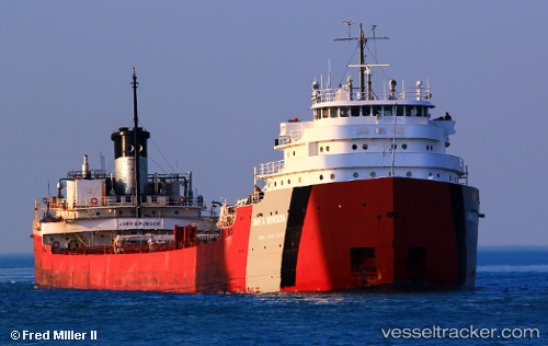
Vessel John G Munson IMO: 5173670, MMSI: 366971360 Self Discharging Bulk Carrier
UTC, 41.70445, -83.44793, course: 59, speed: 8.6
UTC, 41.87270, -82.96282, course: 95, speed: 13.7
2026-01-17 13:52:37 UTC, 41.86721, -82.79831, course: 85, speed: 14.1
Live AIS position:
UTC. Near Scudder),
updated 2026-01-17 13:52:37 UTC.
Find the position of the vessel John G Munson on the map. The latter are known coordinates and path.
marine traffic ship tracker show on live map
The current position of vessel John G Munson is 41.86721 lat / -82.79831 lng. Updated: 2026-01-17 13:52:37 UTCCurrently sailing under the flag of USA
John G Munson built in 1952 year
Deadweight:
26011 tDetails:
Last coordinates of the vessel:
UTC, 41.69767, -83.45947, course: 98, speed: 1.9UTC, 41.70445, -83.44793, course: 59, speed: 8.6
UTC, 41.87270, -82.96282, course: 95, speed: 13.7
2026-01-17 13:52:37 UTC, 41.86721, -82.79831, course: 85, speed: 14.1