 vesseltracker.com
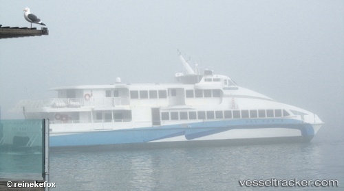
Vessel Del Norte IMO: 8967838, MMSI: 366990520 Passenger Ship
UTC, 37.94411, -122.50861, course: -1, speed: 0
UTC, 37.94417, -122.50864, course: -1, speed: 0
2026-03-24 13:54:09 UTC, 37.94420, -122.50858, course: -1, speed: 0
Live Vessel Del Norte Analytics (details, animations, etc.)
Live AIS position: UTC. Near Green Brae), updated 2026-03-24 13:54:09 UTC.Find the position of the vessel Del Norte on the map. The latter are known coordinates and path.
marine traffic ship tracker show on live map
The current position of vessel Del Norte is 37.94420 lat / -122.50858 lng. Updated: 2026-03-24 13:54:09 UTCCurrently sailing under the flag of USA
Details:
Last coordinates of the vessel:
UTC, 37.94416, -122.50862, course: -1, speed: 0UTC, 37.94411, -122.50861, course: -1, speed: 0
UTC, 37.94417, -122.50864, course: -1, speed: 0
2026-03-24 13:54:09 UTC, 37.94420, -122.50858, course: -1, speed: 0