 vesseltracker.com
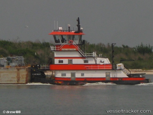
Vessel Father Seelos IMO: 8991011, MMSI: 366997750 Tug
UTC, 28.75848, -95.67842, course: 241, speed: 6.7
UTC, 28.70500, -95.92167, course: -1, speed: 7
2026-03-06 18:33:23 UTC, 28.69833, -95.93833, course: -1, speed: 7
Live Vessel Father Seelos Analytics (details, animations, etc.)
Live AIS position: UTC. 15 nm E of PALACIOS), updated 2026-03-06 18:33:23 UTC.Find the position of the vessel Father Seelos on the map. The latter are known coordinates and path.
marine traffic ship tracker show on live map
The current position of vessel Father Seelos is 28.69833 lat / -95.93833 lng. Updated: 2026-03-06 18:33:23 UTCCurrently sailing under the flag of USA
Details:
Last coordinates of the vessel:
UTC, 28.79530, -95.57007, course: 248, speed: 0UTC, 28.75848, -95.67842, course: 241, speed: 6.7
UTC, 28.70500, -95.92167, course: -1, speed: 7
2026-03-06 18:33:23 UTC, 28.69833, -95.93833, course: -1, speed: 7