 vesseltracker.com
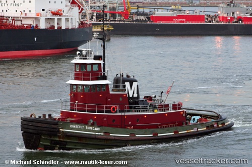
Vessel Kimberly Turecamo IMO: 7914573, MMSI: 367061980 Tug
UTC, 42.62667, -73.75333, course: -1, speed: 0
UTC, 42.62667, -73.75333, course: -1, speed: 0
2026-03-03 07:50:47 UTC, 42.62667, -73.75333, course: -1, speed: 0
Live AIS position:
UTC. Near Albany),
updated 2026-03-03 07:50:47 UTC.
Find the position of the vessel Kimberly Turecamo on the map. The latter are known coordinates and path.
marine traffic ship tracker show on live map
The current position of vessel Kimberly Turecamo is 42.62667 lat / -73.75333 lng. Updated: 2026-03-03 07:50:47 UTCCurrently sailing under the flag of USA
Kimberly Turecamo built in 1980 year
Details:
Last coordinates of the vessel:
UTC, 42.62667, -73.75333, course: -1, speed: 0UTC, 42.62667, -73.75333, course: -1, speed: 0
UTC, 42.62667, -73.75333, course: -1, speed: 0
2026-03-03 07:50:47 UTC, 42.62667, -73.75333, course: -1, speed: 0