 vesseltracker.com
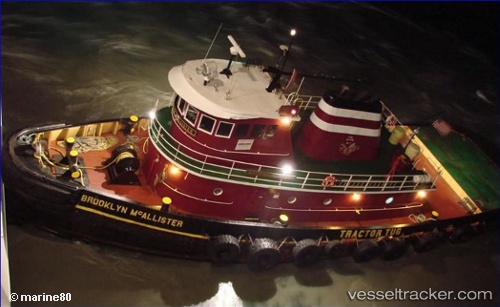
Vessel Brooklyn Mcallister IMO: 8602294, MMSI: 367066970 Tug
UTC, 40.45235, -74.04926, course: -1, speed: 0
UTC, 40.45167, -74.04833, course: -1, speed: 0
2026-03-03 23:45:31 UTC, 40.45167, -74.04833, course: -1, speed: 0
Live AIS position:
UTC. Near FORT HANCOCK),
updated 2026-03-03 23:45:31 UTC.
Find the position of the vessel Brooklyn Mcallister on the map. The latter are known coordinates and path.
marine traffic ship tracker show on live map
The current position of vessel Brooklyn Mcallister is 40.45167 lat / -74.04833 lng. Updated: 2026-03-03 23:45:31 UTCCurrently sailing under the flag of USA
Brooklyn Mcallister built in 1986 year
Details:
Last coordinates of the vessel:
UTC, 40.45167, -74.04833, course: -1, speed: 0UTC, 40.45235, -74.04926, course: -1, speed: 0
UTC, 40.45167, -74.04833, course: -1, speed: 0
2026-03-03 23:45:31 UTC, 40.45167, -74.04833, course: -1, speed: 0