 vesseltracker.com
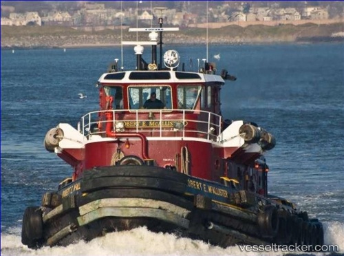
Vessel Robert E. Mcallister IMO: 9068574, MMSI: 367091120 Tug
UTC, 39.80909, -75.41509, course: -1, speed: 0
UTC, 39.80909, -75.41509, course: -1, speed: 0
2026-03-02 19:17:35 UTC, 39.80904, -75.41499, course: -1, speed: 0
Live AIS position:
UTC. Near Marcus Hook),
updated 2026-03-02 19:17:35 UTC.
Find the position of the vessel Robert E. Mcallister on the map. The latter are known coordinates and path.
marine traffic ship tracker show on live map
The current position of vessel Robert E. Mcallister is 39.80904 lat / -75.41499 lng. Updated: 2026-03-02 19:17:35 UTCCurrently sailing under the flag of USA
Robert E. Mcallister built in 1970 year
Deadweight:
92 tDetails:
Last coordinates of the vessel:
UTC, 39.80909, -75.41510, course: -1, speed: 0UTC, 39.80909, -75.41509, course: -1, speed: 0
UTC, 39.80909, -75.41509, course: -1, speed: 0
2026-03-02 19:17:35 UTC, 39.80904, -75.41499, course: -1, speed: 0