 vesseltracker.com
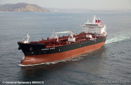
Vessel Garden State IMO: 9698006, MMSI: 367102000 Chemical Oil Products Tanker
UTC, 29.99211, -90.41434, course: 108, speed: 13.1
UTC, 29.93230, -89.98944, course: 127, speed: 13
2026-03-05 19:50:10 UTC, 29.72029, -89.98814, course: -1, speed: 12.5
Live Vessel Garden State Analytics (details, animations, etc.)
Live AIS position: UTC. Near Wills Point), updated 2026-03-05 19:50:10 UTC.Find the position of the vessel Garden State on the map. The latter are known coordinates and path.
marine traffic ship tracker show on live map
The current position of vessel Garden State is 29.72029 lat / -89.98814 lng. Updated: 2026-03-05 19:50:10 UTCDetails:
Last coordinates of the vessel:
UTC, 30.04867, -90.63868, course: -1, speed: 0UTC, 29.99211, -90.41434, course: 108, speed: 13.1
UTC, 29.93230, -89.98944, course: 127, speed: 13
2026-03-05 19:50:10 UTC, 29.72029, -89.98814, course: -1, speed: 12.5