 vesseltracker.com
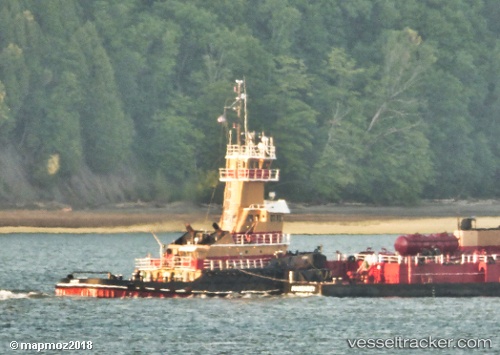
Vessel Albert IMO: 7517686, MMSI: 367159020 Pusher Tug
UTC, 43.01042, -87.89804, course: -1, speed: 0
UTC, 43.01042, -87.89804, course: -1, speed: 0
UTC, 43.01042, -87.89804, course: -1, speed: 0
2026-01-13 15:24:28 UTC, 43.01042, -87.89804, course: -1, speed: 0
Live AIS position:
UTC. Near MILWAUKEE),
updated 2026-01-13 15:24:28 UTC.
Find the position of the vessel Albert on the map. The latter are known coordinates and path.
marine traffic ship tracker show on live map
The current position of vessel Albert is 43.01042 lat / -87.89804 lng. Updated: 2026-01-13 15:24:28 UTCCurrently sailing under the flag of USA
Albert built in 1979 year
Deadweight:
478 tDetails:
Last coordinates of the vessel:
UTC, 43.01042, -87.89804, course: -1, speed: 0UTC, 43.01042, -87.89804, course: -1, speed: 0
UTC, 43.01042, -87.89804, course: -1, speed: 0
UTC, 43.01042, -87.89804, course: -1, speed: 0
2026-01-13 15:24:28 UTC, 43.01042, -87.89804, course: -1, speed: 0