 vesseltracker.com
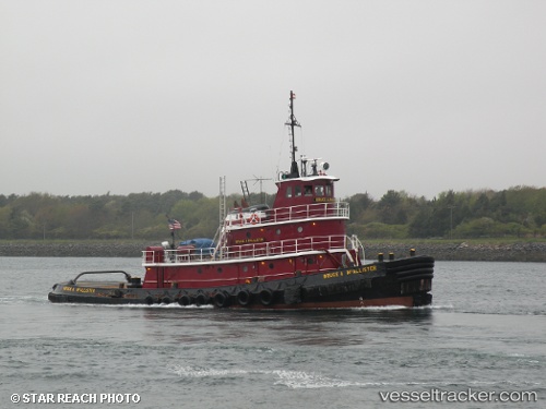
Vessel BRUCE A. MCALLISTER IMO: 7391018, MMSI: 367165430 Tug
UTC, 40.66204, -74.15528, course: 90, speed: 0
UTC, 40.66326, -74.14396, course: 200, speed: 1.3
2026-03-02 21:50:31 UTC, 40.69491, -74.14311, course: 241, speed: 0.1
Live AIS position:
UTC. Near Newark),
updated 2026-03-02 21:50:31 UTC.
Find the position of the vessel BRUCE A. MCALLISTER on the map. The latter are known coordinates and path.
marine traffic ship tracker show on live map
The current position of vessel BRUCE A. MCALLISTER is 40.69491 lat / -74.14311 lng. Updated: 2026-03-02 21:50:31 UTCCurrently sailing under the flag of United States of America
BRUCE A. MCALLISTER built in 1974 year
Deadweight:
0 tDetails:
Last coordinates of the vessel:
UTC, 40.66194, -74.15512, course: 6, speed: 0UTC, 40.66204, -74.15528, course: 90, speed: 0
UTC, 40.66326, -74.14396, course: 200, speed: 1.3
2026-03-02 21:50:31 UTC, 40.69491, -74.14311, course: 241, speed: 0.1