 vesseltracker.com
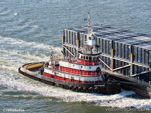
Vessel Pathfinder IMO: 7235214, MMSI: 367191190 Tug
UTC, 40.76990, -73.85009, course: 154, speed: 0
UTC, 40.76986, -73.85011, course: 153, speed: 0
2026-01-15 10:08:54 UTC, 40.76986, -73.85011, course: 153, speed: 0
Live AIS position:
UTC. Near East Elmhurst),
updated 2026-01-15 10:08:54 UTC.
Find the position of the vessel Pathfinder on the map. The latter are known coordinates and path.
marine traffic ship tracker show on live map
The current position of vessel Pathfinder is 40.76986 lat / -73.85011 lng. Updated: 2026-01-15 10:08:54 UTCCurrently sailing under the flag of USA
Pathfinder built in 1972 year
Deadweight:
167 tDetails:
Last coordinates of the vessel:
UTC, 40.75083, -73.96376, course: 43, speed: 8.4UTC, 40.76990, -73.85009, course: 154, speed: 0
UTC, 40.76986, -73.85011, course: 153, speed: 0
2026-01-15 10:08:54 UTC, 40.76986, -73.85011, course: 153, speed: 0