 vesseltracker.com
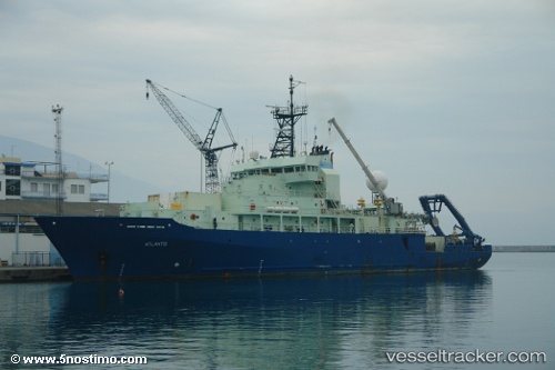
Vessel Atlantis IMO: 9105798, MMSI: 367241000 Research Vessel
UTC, 11.75500, -80.33333, course: -1, speed: 11
UTC, 12.28776, -80.43977, course: 357, speed: 11.5
2026-02-05 03:55:09 UTC, 12.56167, -80.48167, course: -1, speed: 11
Live AIS position:
UTC. 71 nm E of San Andrés),
updated 2026-02-05 03:55:09 UTC.
Find the position of the vessel Atlantis on the map. The latter are known coordinates and path.
marine traffic ship tracker show on live map
The current position of vessel Atlantis is 12.56167 lat / -80.48167 lng. Updated: 2026-02-05 03:55:09 UTCCurrently sailing under the flag of USA
Atlantis built in 1997 year
Deadweight:
1332 tDetails:
Last coordinates of the vessel:
UTC, 11.46240, -80.26738, course: 352, speed: 11.7UTC, 11.75500, -80.33333, course: -1, speed: 11
UTC, 12.28776, -80.43977, course: 357, speed: 11.5
2026-02-05 03:55:09 UTC, 12.56167, -80.48167, course: -1, speed: 11