 vesseltracker.com
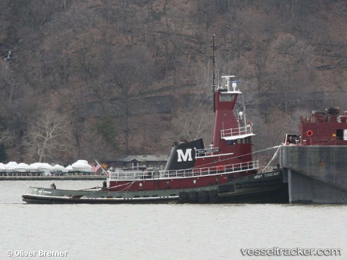
Vessel Mary Turecamo IMO: 8201258, MMSI: 367304010 Tug
2026-03-06 20:06:40 UTC, 40.64053, -74.12950, course: -1, speed: 0
Live Vessel Mary Turecamo Analytics (details, animations, etc.)
Live AIS position: UTC. Near Port Ivory/Staten Isl/New York), updated 2026-03-06 20:06:40 UTC.Find the position of the vessel Mary Turecamo on the map. The latter are known coordinates and path.
marine traffic ship tracker show on live map
The current position of vessel Mary Turecamo is 40.64053 lat / -74.12950 lng. Updated: 2026-03-06 20:06:40 UTCDetails:
Last coordinates of the vessel:
UTC, 40.64053, -74.12950, course: -1, speed: 02026-03-06 20:06:40 UTC, 40.64053, -74.12950, course: -1, speed: 0