 vesseltracker.com
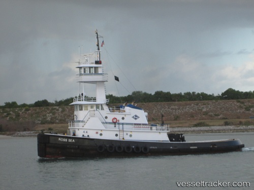
Vessel Ross Sea IMO: 8983105, MMSI: 367334360 Tug
UTC, 39.96964, -75.11013, course: 30, speed: 0.2
UTC, 39.97001, -75.10930, course: 71, speed: 0
2026-03-10 09:44:33 UTC, 39.88674, -75.18042, course: 262, speed: 0
Live Vessel Ross Sea Analytics (details, animations, etc.)
Live AIS position: UTC. Near Brooklawn), updated 2026-03-10 09:44:33 UTC.Find the position of the vessel Ross Sea on the map. The latter are known coordinates and path.
marine traffic ship tracker show on live map
The current position of vessel Ross Sea is 39.88674 lat / -75.18042 lng. Updated: 2026-03-10 09:44:33 UTCCurrently sailing under the flag of USA
Ross Sea built in 2003 year
Deadweight:
180 tDetails:
Last coordinates of the vessel:
UTC, 39.96856, -75.11087, course: 254, speed: 0UTC, 39.96964, -75.11013, course: 30, speed: 0.2
UTC, 39.97001, -75.10930, course: 71, speed: 0
2026-03-10 09:44:33 UTC, 39.88674, -75.18042, course: 262, speed: 0