 vesseltracker.com
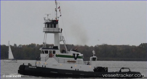
Vessel Anacostia IMO: 9544217, MMSI: 367371820 Pusher Tug
UTC, 41.28667, -72.90833, course: -1, speed: 0
UTC, 41.28667, -72.90833, course: -1, speed: 0
2026-03-03 22:06:33 UTC, 41.28667, -72.90833, course: -1, speed: 0
Live AIS position:
UTC. Near Bayview),
updated 2026-03-03 22:06:33 UTC.
Find the position of the vessel Anacostia on the map. The latter are known coordinates and path.
marine traffic ship tracker show on live map
The current position of vessel Anacostia is 41.28667 lat / -72.90833 lng. Updated: 2026-03-03 22:06:33 UTCCurrently sailing under the flag of USA
Anacostia built in 2009 year
Deadweight:
364 tDetails:
Last coordinates of the vessel:
UTC, 41.28667, -72.90833, course: -1, speed: 0UTC, 41.28667, -72.90833, course: -1, speed: 0
UTC, 41.28667, -72.90833, course: -1, speed: 0
2026-03-03 22:06:33 UTC, 41.28667, -72.90833, course: -1, speed: 0