 vesseltracker.com
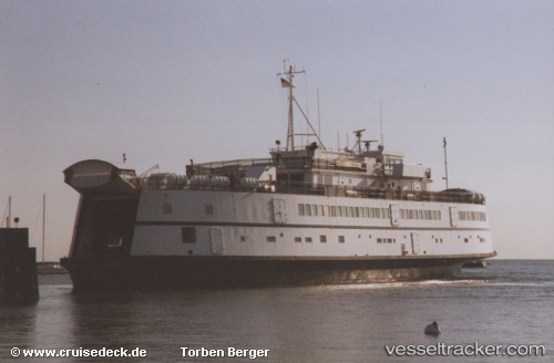
Vessel Marthas Vineyard IMO: 9103881, MMSI: 367376740 Passenger Ro Ro Cargo Ship
UTC, 41.45556, -70.59961, course: 82, speed: 0
UTC, 41.45558, -70.59959, course: 82, speed: 0
2026-03-10 07:56:31 UTC, 41.45555, -70.59962, course: 82, speed: 0
Live Vessel Marthas Vineyard Analytics (details, animations, etc.)
Live AIS position: UTC. Near VINEYARD HAVEN), updated 2026-03-10 07:56:31 UTC.Find the position of the vessel Marthas Vineyard on the map. The latter are known coordinates and path.
marine traffic ship tracker show on live map
The current position of vessel Marthas Vineyard is 41.45555 lat / -70.59962 lng. Updated: 2026-03-10 07:56:31 UTCDetails:
Last coordinates of the vessel:
UTC, 41.45556, -70.59959, course: 82, speed: 0UTC, 41.45556, -70.59961, course: 82, speed: 0
UTC, 41.45558, -70.59959, course: 82, speed: 0
2026-03-10 07:56:31 UTC, 41.45555, -70.59962, course: 82, speed: 0