 vesseltracker.com
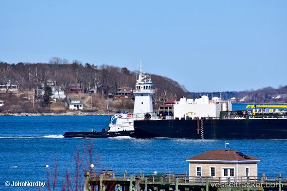
Vessel Blue Fin IMO: 9565596, MMSI: 367416750 Pusher Tug
UTC, 29.30189, -89.36845, course: 146, speed: 11.2
UTC, 29.15154, -89.25506, course: 184, speed: 10.5
2026-01-14 05:59:13 UTC, 29.06362, -89.30775, course: 217, speed: 7.6
Live AIS position:
UTC. Near Southwest Pass),
updated 2026-01-14 05:59:13 UTC.
Find the position of the vessel Blue Fin on the map. The latter are known coordinates and path.
marine traffic ship tracker show on live map
The current position of vessel Blue Fin is 29.06362 lat / -89.30775 lng. Updated: 2026-01-14 05:59:13 UTCCurrently sailing under the flag of USA
Blue Fin built in 2010 year
Deadweight:
428 tDetails:
Last coordinates of the vessel:
UTC, 29.39810, -89.59886, course: 144, speed: 11.1UTC, 29.30189, -89.36845, course: 146, speed: 11.2
UTC, 29.15154, -89.25506, course: 184, speed: 10.5
2026-01-14 05:59:13 UTC, 29.06362, -89.30775, course: 217, speed: 7.6