 vesseltracker.com
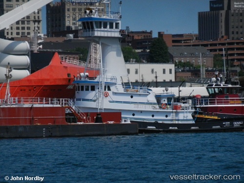
Vessel Denali IMO: 9592185, MMSI: 367452180 Tug
UTC, 40.78403, -73.99599, course: 26, speed: 0
UTC, 40.78500, -73.99500, course: -1, speed: 0
2026-03-02 00:11:21 UTC, 40.78696, -73.99332, course: 227, speed: 0.1
Live AIS position:
UTC. Near Manhattan/New York),
updated 2026-03-02 00:11:21 UTC.
Find the position of the vessel Denali on the map. The latter are known coordinates and path.
marine traffic ship tracker show on live map
The current position of vessel Denali is 40.78696 lat / -73.99332 lng. Updated: 2026-03-02 00:11:21 UTCCurrently sailing under the flag of USA
Denali built in 2010 year
Deadweight:
278 tDetails:
Last coordinates of the vessel:
UTC, 40.78401, -73.99605, course: 27, speed: 0.1UTC, 40.78403, -73.99599, course: 26, speed: 0
UTC, 40.78500, -73.99500, course: -1, speed: 0
2026-03-02 00:11:21 UTC, 40.78696, -73.99332, course: 227, speed: 0.1