 vesseltracker.com
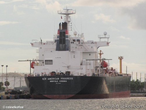
Vessel Oregon IMO: 9118628, MMSI: 367455770 Crude Oil Tanker
UTC, 30.03529, -94.03608, course: -1, speed: 0
UTC, 30.03530, -94.03607, course: 65, speed: 0
2026-03-14 17:25:50 UTC, 30.03535, -94.03606, course: -1, speed: 0
Live Vessel Oregon Analytics (details, animations, etc.)
Live AIS position: UTC. Near Dowling), updated 2026-03-14 17:25:50 UTC.Find the position of the vessel Oregon on the map. The latter are known coordinates and path.
marine traffic ship tracker show on live map
The current position of vessel Oregon is 30.03535 lat / -94.03606 lng. Updated: 2026-03-14 17:25:50 UTCCurrently sailing under the flag of USA
Oregon built in 1997 year
Deadweight:
46103 tDetails:
Last coordinates of the vessel:
UTC, 30.03500, -94.03500, course: -1, speed: 0UTC, 30.03529, -94.03608, course: -1, speed: 0
UTC, 30.03530, -94.03607, course: 65, speed: 0
2026-03-14 17:25:50 UTC, 30.03535, -94.03606, course: -1, speed: 0