 vesseltracker.com
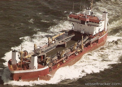
Vessel Padre Island IMO: 8101783, MMSI: 367525000 Hopper Dredger
UTC, 26.77531, -80.02635, course: 209, speed: 0.5
UTC, 26.72208, -80.02898, course: 172, speed: 0.2
2026-03-25 04:17:14 UTC, 26.77557, -80.02585, course: 205, speed: 0.8
Live Vessel Padre Island Analytics (details, animations, etc.)
Live AIS position: UTC. Near Palm Beach), updated 2026-03-25 04:17:14 UTC.Find the position of the vessel Padre Island on the map. The latter are known coordinates and path.
marine traffic ship tracker show on live map
The current position of vessel Padre Island is 26.77557 lat / -80.02585 lng. Updated: 2026-03-25 04:17:14 UTCDetails:
Last coordinates of the vessel:
UTC, 26.77487, -80.02792, course: 208, speed: 0.6UTC, 26.77531, -80.02635, course: 209, speed: 0.5
UTC, 26.72208, -80.02898, course: 172, speed: 0.2
2026-03-25 04:17:14 UTC, 26.77557, -80.02585, course: 205, speed: 0.8