 vesseltracker.com
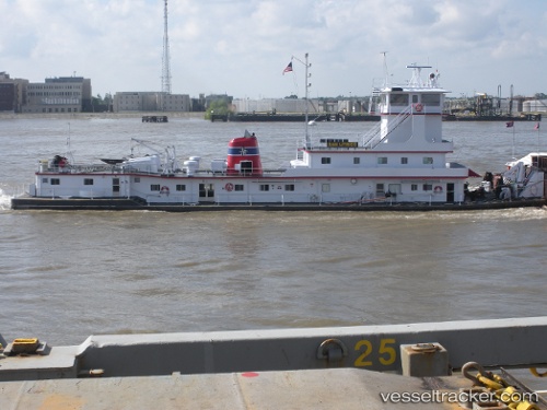
Vessel DAVID M OLOUGHLIN IMO: 8846187, MMSI: 367532910 Spare - Local Vessel
UTC, 30.06979, -90.90323, course: -1, speed: 0
UTC, 30.07580, -90.90566, course: 346, speed: 5.2
2026-03-01 23:38:01 UTC, 30.11852, -90.91398, course: 354, speed: 0.1
Live AIS position:
UTC. Near Burnside),
updated 2026-03-01 23:38:01 UTC.
Find the position of the vessel DAVID M OLOUGHLIN on the map. The latter are known coordinates and path.
marine traffic ship tracker show on live map
The current position of vessel DAVID M OLOUGHLIN is 30.11852 lat / -90.91398 lng. Updated: 2026-03-01 23:38:01 UTCCurrently sailing under the flag of United States
Details:
Last coordinates of the vessel:
UTC, 30.07152, -90.90533, course: 284, speed: 0UTC, 30.06979, -90.90323, course: -1, speed: 0
UTC, 30.07580, -90.90566, course: 346, speed: 5.2
2026-03-01 23:38:01 UTC, 30.11852, -90.91398, course: 354, speed: 0.1